


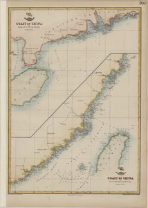
41、 A chart of the northern part of the China Sea : shewing the passage from Formosa to Japan with the Eastern coast of China and the Lekeyo Islands
CollectionAntique Maps of China Map makers Keulen, Gerard van Robert Sayer and John Bennett (Firm) Gaubil, Antoine, 1689-1759 SubjectsNautical charts Geographic regionChina Sea Note Scale ca 1:2,100,000 (E 118°45 --E 130°30 /N 35°--N 24°40...
更多: 知网万方 万方数据 抗日战争与近代中日关系文献数据平台 籍合网 京东 国图 上海图书馆 国图▪文津
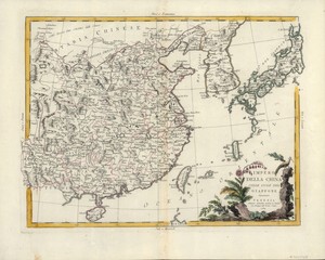
42、 Impero della China colle Isole del Giappone
CollectionAntique Maps of China Map makersZatta, Antonio, active 1757-1797 Subjects Maps Early maps Geographic region China Japan Note Scale not given (E 120°--E 155°/N 40°--N 20°) Relief shown pictorially Call numberG7820 1784 Z3...

43、 Sketch of the Typa and Macao
CollectionAntique Maps of China Map makers Cook, James, 1728-1779 Harrison, William, approximately 1750-1803 Subjects Cook, James, 1728-1779 Maps Nautical charts Travel Geographic region China Taipa Island Macau (China : Special Administ...
更多: 籍合网 抗日战争与近代中日关系文献数据平台 上海图书馆 知网万方 万方数据 国图▪文津 国图

44、 Carte de la Chine : d'après les documens les plus authentiques
CollectionAntique Maps of China Map makersBrion de la Tour, Louis, -1823 Subjects Maps Early maps Geographic regionChina Additional titlesHistoire universelle, depuis le commencement du monde, jusqu à présent Note Scale not determined (E...
更多: 京东 上海图书馆 籍合网 知网万方 万方数据 孔夫子旧书网 国图▪文津 抗日战争与近代中日关系文献数据平台
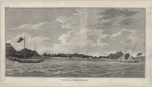
45、 Vue de la ville de Macao
CollectionAntique Maps of China Map makersMeares, John, 1756 -1809 SubjectsPictorial works Geographic region Macau (China : Special Administrative Region) Macau 澳門 Note Appeared in: Meares French ed of Voyages made in the years 1788 and 17...
更多: 知网万方 籍合网 孔夫子旧书网 抗日战争与近代中日关系文献数据平台 国图▪文津

46、 Carte de l'entré de Macao avec la route des vaisseaux pour se rendre a Wampou et celle des Bateaux du pays pour aller par l'interieur a Quanton
CollectionAntique Maps of China Map makers Guignes, Chrétien-Louis-Joseph de, 1759-1845 Houdan, François d SubjectsNautical charts Geographic region Zhujiang Kou (Guangdong, China) Zhujiang Kou (Guangdong) Guangdong Zhujiang Kou 珠江口 廣東 中國...
更多: 知网万方 上海图书馆 孔夫子旧书网 籍合网 抗日战争与近代中日关系文献数据平台 国图▪文津 万方数据 国图
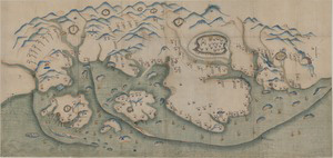
47、 廈門及鄰近地區地圖
CollectionAntique Maps of China Geographic region Xiamen (Fujian, China) Fujian Xiamen 廈門 福建 中國 Additional titles Manuscript map of Amoy and the surrounding region Map of Amoy and the surrounding region Note Scale not given Title supplied...
更多: 国图 国图▪文津 知网万方 万方数据 上海图书馆 京东 抗日战争与近代中日关系文献数据平台 籍合网 孔夫子旧书网

48、 大清弌統天下全圖
CollectionAntique Maps of China Map makers朱錫齡 Geographic region China 中國 Note Not drawn to scale Woodblock print; hand colored Relief shown pictorially Includes list of administrative subdivisions of each province and other descriptive tex...
更多: 上海图书馆 抗日战争与近代中日关系文献数据平台 知网万方 孔夫子旧书网 国图▪文津 籍合网 万方数据 京东
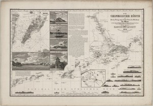
49、 Die Chinesische Küste der Provinz Kuang-tung, zu beiden Seiten des Meridians von Macao
CollectionAntique Maps of China Map makersBerghaus, Heinrich Karl Wilhelm, 1797-1884 SubjectsNautical charts Geographic region Zhujiang Kou (Guangdong, China) Macau (China : Special Administrative Region) Zhujiang Kou (Guangdong) Macau (Spe...
更多: 孔夫子旧书网 万方数据 籍合网 京东 国图▪文津 国图 上海图书馆 抗日战争与近代中日关系文献数据平台 知网万方

50、 Chou-kïang or Canton River
CollectionAntique Maps of China Map makers Belcher, Edward, Sir, 1799-1877 Ross, Daniel Great Britain Hydrographic Office Geographic region Zhujiang Kou (Guangdong, China) Guangdong Zhujiang Kou Note Scale not given Depth shown by soundin...
更多: 国图▪文津 抗日战争与近代中日关系文献数据平台 知网万方 京东 孔夫子旧书网 国图 上海图书馆
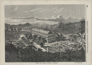
51、 View of Hong Kong, China
CollectionAntique Maps of China Subjects Murray House (Hong Kong, China) Pictorial works Geographic region Victoria Harbor (Hong Kong, China) Hong Kong Victoria Harbor 美利樓 維多利亞港 香港 中國 NoteTear sheet consists of p 160, removed from Ballou ...
更多: 籍合网 知网万方 国图▪文津 抗日战争与近代中日关系文献数据平台 万方数据

53、 View in Hong Kong
CollectionAntique Maps of China Subjects Botanical Garden (Hong Kong, China) Pictorial works Government House (Hong Kong, China) Geographic region Victoria Harbor (Hong Kong, China) Hong Kong Victoria Harbor 維多利亞港 香港 中國 NoteTear sheet Tex...
更多: 国图▪文津 孔夫子旧书网 抗日战争与近代中日关系文献数据平台 京东 籍合网 知网万方
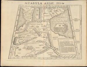
54、 Tabvla Asiae III
CollectionAntique Maps of China Map makers Münster, Sebastian, 1489-1552 Ptolemy, active 2nd century SubjectsMaps Geographic region Asia Armenia Additional titlesGeographia Note Scale not given Caption title Includes list of cities for C...
更多: 京东 万方数据 上海图书馆 国图 抗日战争与近代中日关系文献数据平台

55、 Tabvla Asiae IX
CollectionAntique Maps of China Map makers Münster, Sebastian, 1489-1552 Ptolemy, active 2nd century SubjectsMaps Geographic regionAsia, Central Additional titlesGeographia Note Scale not given Caption title Relief shown pictorially Appe...
更多: 国图 知网万方 上海图书馆 国图▪文津 孔夫子旧书网 京东 抗日战争与近代中日关系文献数据平台 万方数据 籍合网
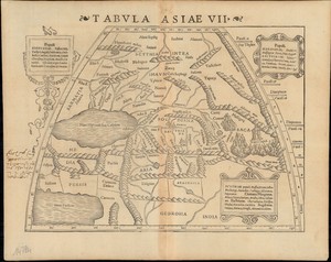
56、 Tabvla Asiae VII
CollectionAntique Maps of China Map makers Münster, Sebastian, 1489-1552 Ptolemy, active 2nd century SubjectsMaps Geographic regionAsia, Central Additional titlesGeographia Note Scale not given Caption title Relief shown pictorially Appe...
更多: 国图▪文津 籍合网 抗日战争与近代中日关系文献数据平台 万方数据 国图 孔夫子旧书网 京东 知网万方
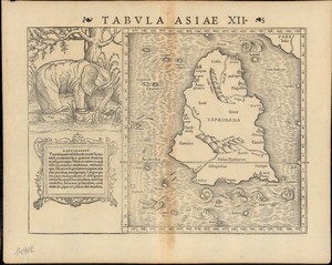
57、 Tabvla Asiae XII
CollectionAntique Maps of China Map makers Münster, Sebastian, 1489-1552 Ptolemy, active 2nd century SubjectsMaps Geographic region Asia Sri Lanka Additional titlesGeographia Note Scale not given Caption title Relief shown pictorially Ap...
更多: 知网万方 京东 国图▪文津 国图 万方数据 上海图书馆 孔夫子旧书网 抗日战争与近代中日关系文献数据平台 籍合网
58、 Seconda tavola
CollectionAntique Maps of China Map makers Ramusio, Giovanni Battista, 1485-1557 Gastaldi, Giacomo, approximately 1500-approximately 1565 Geographic region South Asia Middle East Note Scale not given Relief shown pictorially Attributed to...
更多: 抗日战争与近代中日关系文献数据平台 京东 上海图书馆 国图 籍合网 孔夫子旧书网 国图▪文津 知网万方
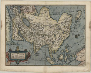
59、 Asiae nova descriptio
CollectionAntique Maps of China Map makersOrtelius, Abraham, 1527-1598 Geographic regionAsia Note Scale not given Relief shown pictorially Hand colored Text on verso Published in the author s Theatrum orbis terrarum LanguageLatin Call numb...
更多: 京东 抗日战争与近代中日关系文献数据平台 籍合网 国图 万方数据

60、 Tabvla Asiae V
CollectionAntique Maps of China Map makers Münster, Sebastian, 1489-1552 Ptolemy, active 2nd century SubjectsMaps Geographic region Syria Middle East Additional titlesGeographia Note Scale not given Caption title Relief shown pictoriall...
更多: 京东 抗日战争与近代中日关系文献数据平台 万方数据 国图▪文津 知网万方 上海图书馆 籍合网 孔夫子旧书网 国图