


123、 猫公
CollectionMaps of China, Late Qing Dynasty-1949 Map makers澁谷紀三郎 SubjectsSoils Geographic regionFeng-pin hsiang (Hua-lien hsien) NoteScale 1:100,000 (E121°30 --E122°00 /N23°40 --N23°20 ) LanguageJapanese Call numberG7914 F38J3 1925 S5 DOI10 ...
更多: 国图 抗日战争与近代中日关系文献数据平台 上海图书馆 知网万方 万方数据 孔夫子旧书网 国图▪文津 京东


125、 臺東
CollectionMaps of China, Late Qing Dynasty-1949 Map makers澁谷紀三郎 SubjectsSoils Geographic region T‘ai-tung hsien Taiwan 臺東縣 臺灣 NoteScale 1:100,000 (E121°00 --E121°30 /N23°00 --N22°40 ) LanguageJapanese Call numberG7913 T36J3 1925 S5 DOI10 1...
更多: 万方数据 国图▪文津 上海图书馆 抗日战争与近代中日关系文献数据平台 籍合网 京东 孔夫子旧书网 国图
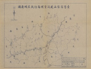


131、 陸軍第一五一師八年來抗戰行動概見圖
CollectionMaps of China, Late Qing Dynasty-1949 Subjects Sino-Japanese War, 1937-1945 Maps 中國 第一五一師 History Additional titlesLu jun di 151 shi 8 nian lai kang zhan xing dong gai jian tu NoteScale 1:2,500,000 LanguageChinese Call numberG782...

132、 馬太鞍
CollectionMaps of China, Late Qing Dynasty-1949 Map makers澁谷紀三郎 SubjectsSoils Geographic regionKuang-fu hsiang (Hua-lien hsien) NoteScale 1:100,000 (E121°00 --E121°30 /N24°00 --N23°40 ) LanguageJapanese Call numberG7914 K82J3 1925 S5 DOI10 ...
更多: 籍合网 国图 国图▪文津 孔夫子旧书网 知网万方 京东 抗日战争与近代中日关系文献数据平台 上海图书馆

133、 General map of China and adjacent regions, showing treaty ports and railways
CollectionMaps of China, Late Qing Dynasty-1949 Map makersGeological Survey (U S ) Topographic Branch Subjects Harbors Railroads Geographic region China East Asia Note Scale 1:10,000,000 1 in = 157 8 miles 1 cm = 100 km ; Lambert conforma...
更多: 国图▪文津 知网万方 抗日战争与近代中日关系文献数据平台 上海图书馆 籍合网 国图 孔夫子旧书网 万方数据

134、 Language map of China
CollectionMaps of China, Late Qing Dynasty-1949 Map makersFenn, Henry C (Henry Courtenay), 1894-1978 SubjectsLanguages Geographic regionChina NoteScale not given LanguageEnglish Call numberG7821 E3 1945 F4 DOI10 14711/spcol/b989419...
更多: 籍合网 国图▪文津 抗日战争与近代中日关系文献数据平台 上海图书馆 知网万方 孔夫子旧书网 万方数据 国图
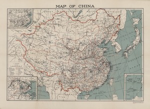
135、 Map of China
CollectionMaps of China, Late Qing Dynasty-1949 Geographic region China 中國 Additional titlesChina handbook Note Scale 1:7,500,000 (E 70°--E 145°/N 45°--N 20°) Reprint China handbook, 1937-1945 Includes insets: China physical -- South China...
更多: 抗日战争与近代中日关系文献数据平台 国图 京东 孔夫子旧书网 知网万方 上海图书馆

136、 Map of China showing the distribution of the missionary body
CollectionMaps of China, Late Qing Dynasty-1949 Map makers China Continuation Committee China Inland Mission Subjects Missions Geography Geographic region China 中國 Additional titles Maps of China New maps of China Note Scale 1:6,000,00...
更多: 国图 籍合网 国图▪文津 抗日战争与近代中日关系文献数据平台 京东 万方数据

137、 Tahiti et Moorea Océan Pacifique
CollectionMaps of China, Late Qing Dynasty-1949 Map makersFrance Dépôt des cartes et plans de la marine SubjectsMaps Geographic region Tahiti (French Polynesia : Island) Moorea (French Polynesia) Note Scale 1:100,870 "3500 " LanguageFrenc...
更多: 万方数据 国图 知网万方 抗日战争与近代中日关系文献数据平台 国图▪文津 孔夫子旧书网
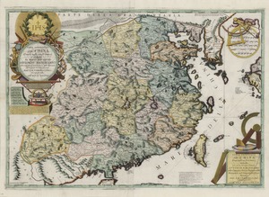
138、 Parte occidentale della China divisa nelle sue provincie
CollectionAntique Maps of China Map makersCoronelli, Vincenzo, 1650-1718 Geographic region China 中國 Additional titlesParte orientale della China Note Scale indeterminable (E136°--E176°/N42°--N19°) Relief shown pictorially Hand colored Lan...
更多: 知网万方 孔夫子旧书网 抗日战争与近代中日关系文献数据平台 万方数据 国图

139、 Imperii Sinarvm nova descriptio
CollectionAntique Maps of China Map makers Winter, Antony de Blaeu, Joan, 1596-1673 SubjectsMaps Geographic regionChina Additional titles Imperii Sinarum nova descriptio Imperii Sinarvm nova descriptio Note Scale not given (E 135°--E 170...
更多: 孔夫子旧书网 知网万方 京东 国图▪文津 籍合网 万方数据 抗日战争与近代中日关系文献数据平台 国图

140、 A map of the XV provinces and CLV capital cities in ye empire of China, the Christian churches and sesidences of Jesuits are marked +
CollectionAntique Maps of China Map makers Le Comte, Louis, 1655-1728 Appears in: Le Comte, Louis, 1655-1728 Subjects Maps Jesuits Missions Geographic regionChina Additional titlesMemoirs and observations topographical, physical, mathemat...
更多: 万方数据 知网万方 京东 抗日战争与近代中日关系文献数据平台 国图▪文津